Directional Drilling in Savannah
America's largest historic landmark district beside North America's busiest single container terminal, with an EV megasite rising in the pines and salt marsh threading everything between. Georgia-coast HDD is preservation-grade drilling in a port that never stops growing — and it's ours.
HDD is the whole job here
The Georgia coast weaves two grounds into one map: sandy ridges — the old beach lines and bluff stands where every town on this coast was wisely built — and the salt marsh between them, the vast spartina plain that gives Georgia more tidal marsh than any state on the Atlantic, floored with the soft, organic, gray-black mud the Lowcountry calls pluff. Drilling reads the weave: ridge alignments run agreeable coastal sands with the water table as a steady companion; marsh-edge and causeway alignments cross into genuinely soft ground — organics, muck, and tidal water — where the program becomes settlement-aware engineering with buoyancy math, engineered pits, and estuary-grade containment. The quote names which thread of the weave your alignment follows, because averaging them serves nobody.
The market runs on three engines that rarely share a metro: the port — the busiest single-terminal container operation in North America, still expanding up the harbor with the logistics empire that follows it down every interstate spur; the megasite era — the Hyundai EV metaplant in Bryan County, among the largest industrial projects in Georgia's history, pulling utility programs, supplier campuses, and workforce rooftops across two counties; and the historic city itself — the nation's largest National Historic Landmark district, where utility work is preservation work: brick streets and tabby-era foundations, squares that define the town plan, review-board standards, and above everything the live-oak canopy, protected, beloved, and exactly the kind of obstacle HDD was invented to pass beneath rather than through.
Hurricane awareness and lowcountry drainage complete the local curriculum — this coast plans for water arriving from both sky and sea. Behind it all sits the network desk — 50,000+ boring calls answered, ~10,000 crossings quoted, 2,000+ drilled — pricing the Georgia coast with the marsh weave already in the math.
Fiber-Optic Boring
Port and logistics duct, megasite-corridor builds, and canopy-safe city fiber.
Electrical Duct Boring
Feeders for the port's empire, the metaplant era, and a hurricane-wise coast.
Water & Force-Main Boring
Pressure pipe for systems racing megasite growth on a marsh-laced map.
Savannah River & Marsh Crossings
The signature coastal bore: the working harbor and the spartina plain around it.
Road & Highway Crossings
Brick streets to interstate spurs — preservation manners one mile, port freight the next.
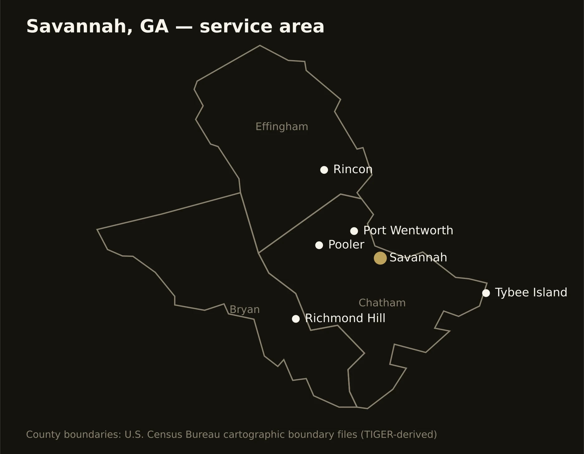
Three counties on the coast — Chatham holding the historic city, the port, the islands, and the marsh; Bryan running Richmond Hill and the megasite country south; and Effingham carrying Rincon's growth and the sand ridges north. Full county list on the service-area page.